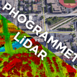
Learn What Is Photogrammetry And Its Various Applications
10 July 2019Table of Contents
Learn What Is Photogrammetry And Its Various Applications
In this article, we are presenting a brief introduction to what is photogrammetry and its various applications for those who are new to this technology.
What is Photogrammetry?
In a straightforward language, Photogrammetry is a technology that combines photography and geometry. It has a significant impact on the current architectural works.
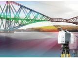
As the name implies, Photogrammetry is a 3-Dimensional coordinate measuring method that makes use of photographs as the primary medium for measurement. The classical definition of the Photogrammetry is the simple process of deriving metric information about an object through measurements made on the photograph of that object.
Furthermore, photogrammetry is the science or the art of making measurements from the photographs. It means the measuring of features on photographs.
Photogrammetry uses the fundamental principles of triangulation called as Aerial Triangulation. In this method, a photograph gets snap from at least two different locations called “Line of sight,” and it can develop from each camera to points on the object.
The mathematical intersection of these lines can generate the 3D coordinates of the points of interest.
History of Photogrammetry
The Photogrammetry method was initially in use by the Prussian Architect in 1867 who designed some of the earliest topographic maps and some elevation drawings. The photogrammetry service in the topographic mapping is well-established but in the current scenario, the application of photogrammetry is common in the fields of architecture, engineering, forensic, underwater, medicine and much more for the production of accurate 3D data.
The term photogrammetry describes from the three simple words:
‘Photo’ – Light
‘gram’ – Drawing
‘metry’ – Measurement
“Photogrammetry means Light Drawing Measurement”
The output of this method is typically a map, drawings, measurement or a 3D model of some real-world objects. Many of the maps we are using are generated with the help of this technique, while the photographs are taken from the aircrafts.
Application of Photogrammetry
The categorization of the photogrammetry is based on the camera location during the actual photography. On these terms, we have Aerial Photogrammetry, Terrestrial Photogrammetry and Space Photogrammetry.
Now let’s understand each application of Photogrammetry in detail.
Aerial Photogrammetry
In this type of photogrammetry, the cameras are launch on a machine that flies aircraft and therefore takes pictures. These pictures are useful in generating the measurements. In this case, for the statistical comparisons, at least two photos of the same object or surface are clicked. This type of photography uses special design planes.
The aircrafts fly over a preset piece of land, pointed with a particular landmark. The camera speed is controlling accordingly to the speed of the plane. Also, the height of the plane from the land is initially defined. The stereo-plotter (an instrument that allows an operator to view two photos at once in a stereo view) processes the photographs. The photographs are also useful in automation processing for Digital Elevation Model (DEM) creation.
Terrestrial Photogrammetry
It is this kind of Photogrammetry technique in which the camera is usable in a stationary position, and hence photographs need to capture from a fixed, known position on or near the ground. The camera tilt and other specifications are in command. Photo Theodolite is a unique instrument that utilizes in exploring the photographs.
Space Photogrammetry
The space photogrammetry adapts all the aspects of extraterrestrial photography as well as measurements wherein the camera is non-moving on the earth or place on artificial satellite or in the space.
The term Photo Interpretation is applicable to that branch of photogrammetry wherein aerial or terrestrial photographs utilize to calculate, analyze, classify and interpret images of objects that are visible on the photographs. As a result, Photogrammetry is a combination of measurement and interpretation of a particular object.
Advantages of Photogrammetry
Photogrammetry has numerous advantages that are beneficial in modern construction as well as various other sectors like:
- Covers large areas quickly.
- The photogrammetry technique is cost-efficient.
- The method is the easiest way to obtain or access information from the air.
- The photographic images illustrate great details.
Application of Photogrammetry
- To quickly verify the spatial positions of the ground objects.
- To prepare topographical maps (surveying/mapping).
- Helpful in Military/Artificial Intelligence.
- For the interpretation of Geology/Archaeology.
- Analysis of crop damages due to floods or other natural disasters.
- To prepare a composite picture of ground objects.
- To relocate existing boundaries of properties.
- Helpful in the field of medicine.
The photogrammetry can generate a data set that will help many organizations or the stakeholders, therefore, helping to create most efficient and effective plan for any construction project.