All you should Know about Surveying and Its Classifications
3 November 2021Table of Contents
All you should Know about Surveying and Its Classification
Here is everything you need to know about surveying and its different classifications.
Surveying is a fundamental element of civil engineering since it is the initial stage in initiating a new civil engineering project.
A student must master the fundamentals of surveying in order to fully understand the procedures.
To begin learning surveying, one must first understand what surveying is and why it is important.
So first of all :
What is surveying ?
Surveying is simply the process of using direct or indirect measurements to determine the relative positions of various features on, above, or beneath the earth’s surface, and then putting them on a sheet of paper known as a plan or map.
Surveying skills are helpful in various of engineering processes. Any engineering project necessitates the use of surveying.
Below are some of the most important aspects of surveying.
You’re just about to know why surveying is that important , keep reading :
Why is it important ?
The first phase in surveying is to draw out a plan and a portion of the region that will be surveyed.
Based on the nature of the project, the best potential alignment, quantity of earthwork, and other relevant information can be computed using these prepared maps and sections.
Surveying measurements are used in the planning and design of all Civil Engineering projects, including railways, highways, tunneling, irrigation, dams, reservoirs, waterworks, sewage works, airfields, ports, enormous structures, and so on.
So, to conclude, any project of any size is built along the lines and points specified by surveying during its implementation as an initiation to its success and full achievement in the best possible ways.
Surveying most common classifications:
In order to get more in depth with surveying, you need to know that its most common classifications are:
- Plane surveying
- Geodetic surveying.
Let’s start with the first one :
Plane surveying :
Plane surveying refers to surveying in which the earth’s mean surface is treated as a plane and the spheroidal shape is ignored.
Plane triangles include all triangles created by survey lines. All plumb lines are parallel and the level line is deemed straight.
We are only concerned with a small portion of the earth’s surface in everyday life, and the above assumptions appear reasonable in light of the fact that the length of an arc 12 kilometers long lying on the earth’s surface is only 1cm greater than the subtended chord, and that the difference between the sum of the angles in a plane triangle and the sum of those in a spherical triangle is only one degree.
And that was all you need to know about plane surveying for now.
Now, let’s jump into the second type of surveying which is « the geodetic surveying ».
Geodetic surveying :
Geodetic surveying the second method of surveying that takes into consideration the shape
of the earth.
The lines on the surface are all curved, and the triangles are all spherical.
As a result, spherical trigonometry is required to be able to master the different phases of
this kind of surveying.
All geodetic surveys entail labor at a bigger scale and with a high level of precision.
We can say that the goal of a geodetic survey is to identify the precise location on the earth’s surface of a set of widely separated sites that serve as control stations for less precise surveys.
To conclude, there are two types of surveying : the plane surveying and the geodetic one.
As a matter a fact, it’s up to the civil engineer to choose the best type based on each project he’s asked to accomplish.
The question now is :
Are there other ways to classify surveying ?
The answer is a massive YES and you’re about to discover some other ways of classifying surveying.
Classification based on nature of field:
There are three categories of surveying that are classified depending on the nature of the field:
- Land surveying : which is divided into three categories: topographical survey, cadastral survey, and city survey.
It is concerned with natural and man-made characteristics on land such as rivers, streams, lakes, wood, hills, highways, trains, canals, towns, water supply systems, buildings and properties, and so on. - Marine surveying : This classification of surveying is also known under the name of hydrographic surveying, is simply the species and elements related to the water for the purposes of navigation, water supply, harbor construction, and mean sea level determination.
Measurement of stream discharge, topographic survey of coasts and banks, taking and locating soundings to establish water depth, and recording ocean tidal fluctuations are actually all part of the job we’re talking about. - Astronomical Surveying: This type of surveying allows a surveyor to determine the absolute location of any point on the earth’s surface, as well as the absolute location and direction of any line.
This entails making observations of celestial bodies like the sun or any fixed star. (this one is quite interesting).
Classification based on instruments used :
Surveying can be split into six groups based on the different types of instruments employed :
- Surveying in a chain
- Surveying using a compass
- Surveying on a plane table
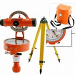
- Surveying using a theodolite
- Tacheometric surveying is a method of measuring the distance between two points.
- Surveying using photographs
Methods used for classification: Or in other words, classification based on the method used .
Surveying can be classified into the following categories based on the methodologies used:
- Surveying via triangulation
- Surveying in a straight line
And … the last surveying classification , and my favorite one is :
Object-based classification:
There are four different forms of surveying based on the object:
- Surveying of the Earth
- Surveying of Mines
- Surveying archaeology
- Military reconnaissance