The LIDAR Terms you must know
23 December 2019The LIDAR Terms you must know
If you want to feel a lot more fluent in the language of LiDAR, you must know theses terms:
Repetition rate: This is the rate at which the laser is pulsing, and it’ll be measured in kilohertz (KHz). Fortunately, you don’t have to count it yourself, because these are extremely quick pulses. If a vendor sells you a sensor operating at 200 KHz, this means the LiDAR will pulse at 200,000 times per second. Not only does the laser transceiver put out 200,000 pulses, the receiver is speedy enough to receive information from these 200,000 pulses.
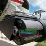
Scan frequency: While the laser is pulsing, the scanner is oscillating, or moving back and forth. The scan frequency tells you how fast the scanner is oscillating. A mobile system has a scanner that rotates continuously in a 360 degree fashion, but most airborne scanners move back and forth.
Scan angle: This is measured in degrees and is the dis-tance that the scanner moves from one end to the other. You’ll adjust the angle depending on the application and the accuracy of the desired data product.
Flying attitude: It’s no surprise that the farther the plat-form is from the target, the lower the accuracy of the data and the less dense the points will be that define the target area. That’s why for airborne systems, the flying attitude is so important.
Flight line spacing: This is another important measure for airborne systems, and it depends on the application, vegetation, and terrain of the area of interest.
Nominal point spacing (NPS): The rule is simple enough — the more points that are hit in your collection, the better you’ll define the targets. The point sample spac-ing varies depending on the application. Keep in mind that LiDAR systems are random sampling systems. Although you can’t determine exactly where the points are going to hit on the target area, you can decide how many times the target areas are going to be hit, so you can choose a higher frequency of points to better define the targets.
Cross track resolution: This is the spacing of the pulses from the LiDAR system in the scanning direction, or per-pendicular to the direction that the platform is moving, in the case of airborne and mobile systems.
Along track resolution: This, on the other hand, is the spacing of the pulses that are in the flight direction or driving direction of the platform.
Swath: This is the actual distance of the area of coverage for the LiDAR system. It can vary depending on the scan angle and flying height. If you’re flying higher, you’ll have a larger swath distance, and you’ll also get a larger swath distance if you increase the scan angle. Mobile LiDAR has a swath, too, but it is usually fixed and depends on the particular sensor. For these systems, though, you might not hear the word “swath;” it may instead be referred to as the “area of coverage,” and will vary depending on the repetition rate of the sensor.
Overlap: Just like it sounds. It’s the amount of redundant area that is covered between flight lines or swaths within an area of interest. Overlap isn’t a wasted effort, though — sometimes it provides more accuracy.
More from my site
 The Best Software For LIDAR Classification
- What is LIDAR? How it works?
- Top 10 Questions You May Have about LiDAR
- How LiDAR is Being Used to Help With Natural Disaster Mapping and Management
- USGS 3DEP Lidar Point Cloud now available as Amazon Public Dataset
- 3D LiDAR technology brought to mass-market with Livox sensor